
The Schluchtensteig is a 119-kilometre long-distance hiking trail right across the Naturpark Südschwarzwald. It leads from Stühlingen to Wehr and links the Wutachschlucht, the Windbergschlucht and the Wehraschlucht.
This article lists the stages with the official lengths and walking times, explains what you should know about the map, hiking passport and getting there, and shows how individual sections can be walked as day trips from our house in Ühlingen-Birkendorf. The starting point Stühlingen is only around 15 km away, about 20 minutes by car.
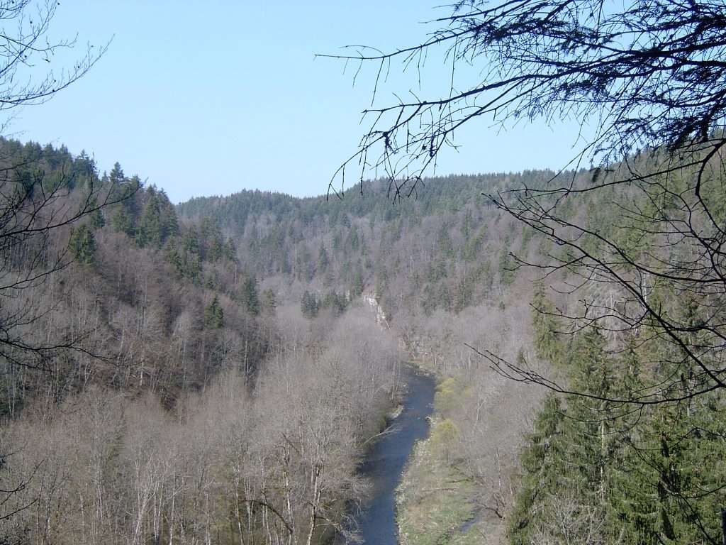
Schluchtensteig: route and key facts
- Length: 119 km from Stühlingen to Wehr
- Elevation gain: 3,180 m of ascent, 3,290 m of descent (total route)
- Stages: six hiking days in the “classic”, five days in the “sporty tour”
- Best time: Schwarzwald Tourismus gives May to October
- Quality: The trail bears the quality seal “Qualitätsweg Wanderbares Deutschland”, certified six times according to the operator, most recently in 2025, and is one of the “Top Trails of Germany”
- Signposting: The Schwarzwaldverein is responsible
According to Schwarzwald Tourismus, the trail requires sure-footedness and a head for heights as well as good footwear, especially in the gorge sections. Individual daily stages are suitable for older children; multi-day tours are rather too strenuous for children.
Schluchtensteig stages at a glance
The figures come from the overview on schluchtensteig.de. The site gives the metres of ascent only for the total route.
| Stage | Track | Length | Walking time |
|---|---|---|---|
| 1 | Stühlingen – Blumberg | 19 km | 5.5 hrs |
| 2 | Blumberg – Schattenmühle | 20 km | 6 hrs |
| 3 | Schattenmühle – Fischbach | 18 km | 6 hrs |
| 4 | Fischbach (Schluchsee) – St. Blasien | 20 km | 5.5 hrs |
| 5 | St. Blasien – Todtmoos | 20 km | 6 hrs |
| 6 | Todtmoos – Wehr | 22 km | 7.5 hrs |
Stage 1: Stühlingen – Blumberg
The stage begins in the lower Wutach valley with broad forest tracks and then leads through the Wutachflühen, where narrow and in places exposed paths run along rock towers. After heavy rain the operator recommends a signposted alternative route there, which is less dangerous and takes somewhat longer. Finally you go over the Buchberg (876 m) with panoramic views to Blumberg.
Stage 2: Blumberg – Schattenmühle
The Wutachschlucht lies on this stage: narrow, in places rocky paths with ladders and steps, rope handrails on rock faces and paths directly by the water. The operator mentions a bypass for dogs and for hikers who do not feel comfortable with heights. We describe the gorge in detail in our article on Hiking in the Wutachschlucht.
Stage 3: Schattenmühle – Fischbach
After a steep ascent at the start, the trail runs mostly level above the Wutach valley. Stops include the Räuberschlösslefelsen viewpoint, the Haslachschlucht, the Rechenfelsen and the Hölllochfelsen as well as the village of Lenzkirch. The destination is Fischbach near Schluchsee; the stage page gives the district of Oberfischbach as the destination.
Stage 4: Fischbach – St. Blasien
The stage climbs moderately but steadily to the Krummenkreuz, at 1,148 m the highest point of this stage. The Bildstein viewing rock (1,134 m) offers, according to the operator, views from the Feldberg across the Schluchsee to the Alps. Next come the Windbergschlucht with the Windbergwasserfall and the first view of the cathedral of St. Blasien.
Stage 5: St. Blasien – Todtmoos
The stage starts in the Kurpark of St. Blasien, climbs to the Lehenkopf (1,039 m) with its lookout tower and leads via Dachsberg, the Ibacher Hochtal and the Hohwehraschlucht to Todtmoos. If you would like to explore the town beforehand, you will find information in our article on St. Blasien and the cathedral.
Stage 6: Todtmoos – Wehr
The last section leads over forest tracks and narrow, in places exposed paths through the Wehraschlucht, with protected forest reserve slopes up to 200 metres high, past the Mettlerhütte with a view of the Swiss Alps and the Wehrastausee. The destination is the castle park in Wehr.
The sporty tour in five days
If you prefer longer daily stages, schluchtensteig.de suggests this split:
- Stühlingen – Wutachmühle: 26 km, 7 hrs
- Wutachmühle – Lenzkirch: 26 km, 7.5 hrs
- Lenzkirch – St. Blasien: 25 km, 7.5 hrs
- St. Blasien – Todtmoos: 20 km, 5.5 hrs
- Todtmoos – Wehr: 22 km, 6.5 hrs
Map, hiking passport and luggage transport
The operator, the Infostelle Schluchtensteig at the Landratsamt Waldshut (district office), offers various materials. According to the brochure order page, the overview flyer, the tour guide and the hiking bus and transfer timetable, among other things, can be ordered free of charge. A hiking map in leporello format is available from bookshops or from the Schwarzwald Tourismus shop; you will find current prices there.
With the hiking passport you collect one stamp per stage, for example at tourist information offices or with hosts. The completed passport is redeemed for a small gift and a certificate. The stamps can be collected in one go or over several day tours.
For luggage transport, the operator refers to package offers under “Wandern ohne Gepäck” (hiking without luggage) from a partner. Please ask there or at the Infostelle on 07751 862660 about prices and services.
Getting there, parking and return
- Start in Stühlingen: By train to Waldshut, then bus 7338 to Stühlingen. If you come by car, you can park free of charge at the Stadthalle Stühlingen; the operator asks that you do not park at Kronenplatz in the town centre.
- Finish in Wehr: Travel via Bad Säckingen or Wehr-Brennet and continue by bus 7320 or 7335 to Wehr bus station. Free parking is available at the bus station, at the Mediathek and in the underground car park.
- Rail: Because of the electrification of the Hochrheinbahn, rail replacement services have been running since 26 April 2026. Please check the current connection with the railway operator.
- Hiking bus: In season, a hiking bus for the Wutach and Gauchach gorges runs at weekends and on public holidays; you will find the timetable on the Schluchtensteig website.
- KONUS guest card: It is valid for buses and trains in the Black Forest and is issued by the first accommodation on check-in. Dogs and bicycles are not covered.
Individual day tours can also be combined with bus and train. For this the operator mentions, for example, stage 2 between Wutachmühle and Schattenmühle and stage 4 between Schluchsee-Aha and St. Blasien.
Current information on the trail
On the page “Current trail information” the operator publishes closures and diversions. Among other things, the Lotenbachklamm is mentioned there: it is not an official part of the Schluchtensteig, but serves as access to the Gündelwangen stop and is closed for the entire 2026 hiking season. The operator also announces renovation work on the upper bridges of the Windbergschlucht, which may lead to short closures.
Please therefore find out the current status before every tour. You can reach the operator at the Infostelle on 07751 862660. Mobile reception is poor in places in the gorges; download timetables and maps to your phone beforehand.
Day stages from our house
From Birkendorf you reach Stühlingen in around 15 km, about 20 minutes by car. The first stage, at 19 km and 5.5 hours, can thus be planned as a day tour. For stage transfers the operator lists buses 7338 (Stühlingen – Fützen) and 913 (Fützen – Blumberg); at weekends there is no bus between Stühlingen station and Blumberg Schulzentrum. We describe other gorges in the area in our articles on the Gauchachschlucht and Wutach Gorge.
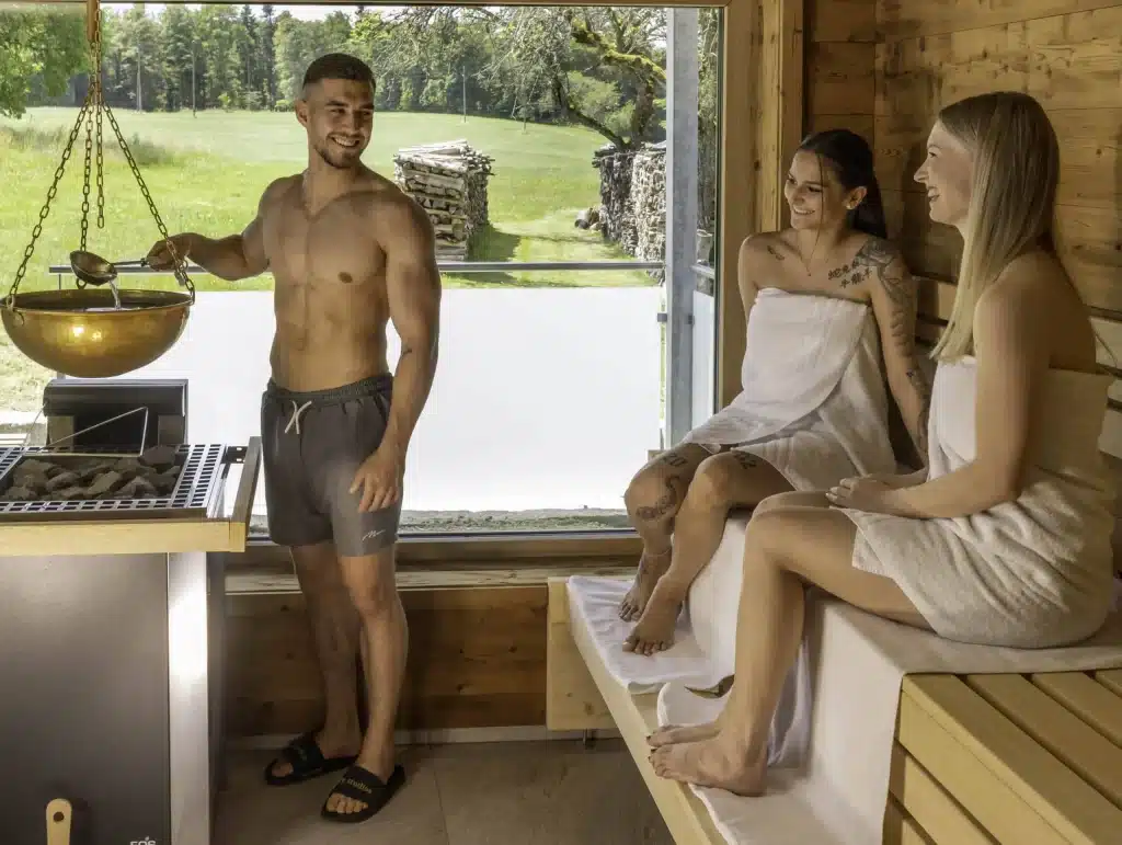
After a long stage, warmth does you good: our Wellness area is open daily from 9:00 to 20:00, with an indoor pool, panoramic sauna with forest views, garden sauna (swimwear allowed), herbal steam sauna (bio sauna) and Kneipp water-treading pool. You can reserve a massage in advance, for example the herbal stamp massage (€59 for 25 minutes, as of October 2026); all prices are on the page Massages.
Our Arrangements, such as “Aktiv im Südschwarzwald”, include accommodation, breakfast buffet, gourmet menu, afternoon snack buffet and use of the spa facilities; the KONUS guest card is also included. You will find more about tours in the region on our page Hiking holiday in the Black Forest and in the article Hiking holiday in the Black Forest in three days. Available dates are shown by the Book page.
Frequently asked questions
How long is the Schluchtensteig?
The Schluchtensteig is 119 km long and leads from Stühlingen to Wehr.
In how many stages do you hike the Schluchtensteig?
The operator offers two ways of splitting it: the classic with six hiking days (18 to 22 km per day) and the sporty tour with five days (20 to 26 km per day).
When is the best time for the Schluchtensteig?
Schwarzwald Tourismus gives May to October. Before the tour, check the current trail information and the weather, as gorge paths can be slippery when wet.
Is the Schluchtensteig difficult?
It requires sure-footedness and a head for heights, especially in the gorge sections. In several places the operator mentions bypasses, for example for dogs and for hikers who are not comfortable with heights in the Wutachschlucht.
Is there a hiking passport?
Yes, with one stamp per stage. The completed passport is redeemed for a small gift and a certificate, for example at the Stühlingen town hall or in Wehr.
How do I get to the starting point Stühlingen?
By train to Waldshut and on by bus 7338; if you come by car, park at the Stadthalle Stühlingen. It is around 15 km from our house, about 20 minutes by car.
Sources
- Schluchtensteig: operator's home page
- Schluchtensteig: overview with stages, lengths and walking times
- Schluchtensteig: Stage 1
- Schluchtensteig: Stage 2
- Schluchtensteig: Stage 3
- Schluchtensteig: Stage 4
- Schluchtensteig: Stage 5
- Schluchtensteig: Stage 6
- Schluchtensteig: Getting there and mobility
- Schluchtensteig: Quality and certification
- Schluchtensteig: Hiking passport
- Schluchtensteig: Current trail information
- Schluchtensteig: Brochures and maps
- Schwarzwald Tourismus: Schluchtensteig
You might also like
Kugelwaldpfad Ühlingen-Birkendorf: Adventure trail for families
Marble run trail in Ühlingen-Birkendorf: 15 stations with wooden balls. On foot from the Hotel Sonnenhof + Sonnhalde, free of charge, ideal for families with children.
Albsteig Black Forest: Stages and highlights
Albstieg Black Forest: 83.3 km from Albbruck to Feldberg, all stages with length and altitude meters, highlights, travel time and arrival from the Sonnenhof hotel.

Ravennaschlucht: Hiking, waterfalls & viaduct in the High Black Forest
The Ravenna Gorge in the Black Forest: hiking routes, two waterfalls, Ravenna Viaduct and the famous Christmas market. Tips & travel from the hotel.
 Deutsch
 English (UK)
 Français
