
Hotzenwald: Excursions and hikes
Inhalt
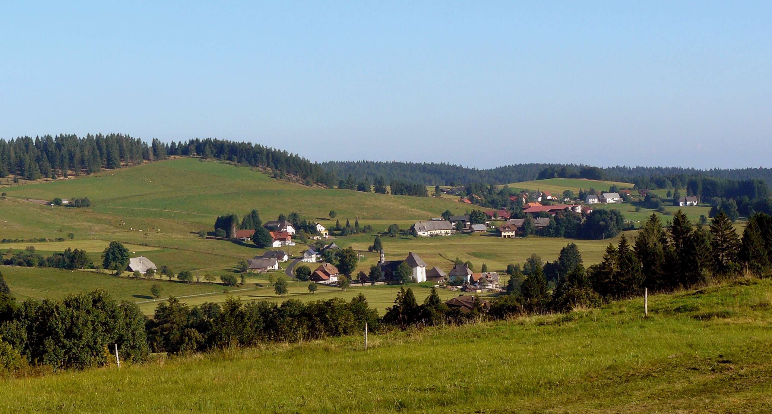
The Hotzenwald is a landscape in the Southern Black Forest between the valleys of the Wehra and the Alb. Narrow valleys and dense forest alternate with open plateaus from which, on clear days, the view stretches as far as the Alps.
This article introduces the Hotzenwald, lists excursion destinations and hikes with official information, and shows how you can discover the region from our hotel in Ühlingen-Birkendorf. Görwihl, a centre of the region, is around 38 km away, about 45 minutes by car.
Hotzenwald: location, landscape and name
The Hotzenwald lies in the Waldshut district. According to the narrower definition given by Wikipedia, it is bounded in the west by the Wehra, in the north by the upper Alb near St. Blasien, in the east by the ridge between the Alb and the Schlücht, and in the south by the High Rhine with the Klettgau. From the High Rhine (around 300 metres above sea level) the land rises quickly to mostly 500 to over 1,000 metres.
According to Wikipedia, the name probably derives from the “Hotzen”, the wide baggy trousers of the Hauenstein costume. The rock is predominantly granite; in addition there are bogs, especially around Ibach and Dachsberg, ten of which, according to Wikipedia, were placed under protection by 1998.
The portal of Hotzenwald Tourismus GmbH describes the area between the Wehra and the Alb with the phrase “Here, space opens up”: narrow valleys and dense forest alternating with open plateaus and long views.
Places and excursion destinations in the Hotzenwald
The portal of Hotzenwald Tourismus GmbH, based in Herrischried, presents Görwihl, Herrischried and Rickenbach. Wikipedia also counts Dachsberg among the core municipalities; on the edge of the region lie, among others, St. Blasien and Todtmoos.
Görwihl
According to Schwarzwald Tourismus, Görwihl lies in the middle of the Hotzenwald and has ten districts. Nearby are the Höllbachwasserfälle and deep gorges. The Heimatmuseum Hotzenwald (local history museum) at Marktplatz 9 shows the history of the former County of Hauenstein over four floors. According to the museum, exhibits include a 4.20-metre-long historic loom that weaves 40 silk ribbons at once, and the only still-working saltpetre works in Germany. Please enquire about opening times and admission on 07754 70810.
Herrischried
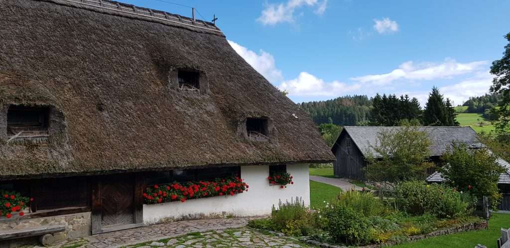
Herrischried is a climatic health resort (Luftkurort) in the Hotzenwald. In summer the village offers hiking and the Stehlesee, in winter an ice rink and winter sports. In the Großherrischwand district lies the Freilichtmuseum Klausenhof (open-air museum): a farm dating from 1424 which, according to Schwarzwald Tourismus, is among the oldest houses in the Black Forest. The grounds also include the Lindauer Säge sawmill, first mentioned in 1595, a cart shed, a farm garden and a bakehouse.
Rickenbach
Rickenbach is likewise a climatic health resort. Schwarzwald Tourismus names the variety of flower meadows and forests as its hallmark. In the municipality lie the Solfelsen and old Wuhre, artificial watercourses along which hiking trails run.
Hikes in the Hotzenwald
The following tours come from the tour database of Schwarzwald Tourismus. All figures are guide values.
| Tour | Length and duration | Metres of ascent | Special feature |
|---|---|---|---|
| From Görwihl to the Albschlucht and the Höllbachwasserfall | 7.28 km, about 3 hrs, easy | 283 m | Circular tour from Heimatmuseum Görwihl, follows the Hotzenwald-Querweg |
| Hotzenwald Höhenweg | 9.3 km, about 2:40 hrs, moderate | 250 m | Circular tour from the hikers’ car park Kreuzfeld (989 m), Marienkapelle am Totenbühl, Ödlandkapelle, Hornbergbecken |
| Walking along the Wuhr: from the Solfelsen to the Heidenwuhr | 10.52 km, about 3 hrs, moderate | 220 m | Circular tour from the hikers’ car park Solfelsen, Hotzenpfad, Alpenblick near Bergalingen |
| Rickenbach: on quiet paths of the Hotzenwald Höhenweg | 12.1 km, about 4 hrs, moderate | 366 m | Circular tour from the hikers’ car park Strick, Hornbergbecken, Ödlandkapelle of 1780 |
Some sections can be very waterlogged after rain, and there is a risk of slipping when wet. Sturdy footwear and weatherproof clothing are therefore advisable.
Hotzenwald-Querweg
The Hotzenwald-Querweg leads in two stages from Schopfheim via Herrischried to Waldshut: Schopfheim – Herrischried (23 km) and Herrischried – Waldshut (23 km). It is waymarked with a yellow diamond and crosses the steep valleys of the Wehra, Murg and Alb with views of the High Rhine, the Swiss Jura and the Alps. Schwarzwald Tourismus rates it as moderate.
Long-distance trails on the edge of the Hotzenwald
The Albsteig hiking trail starts in Albbruck and leads, among other things, through the quiet forests of the Hotzenwald; even the first stage ends in Görwihl. The Slake Steig runs on its sixth stage from Todtmoos through the Wehraschlucht to Wehr, i.e. along the western edge of the region. According to the operator, the Wehraschlucht has protected-forest (Bannwald) slopes up to 200 metres high.
The Salpeterer and the history of the Hotzenwald
Until 1806 the Hotzenwald belonged to Further Austria (Vorderösterreich). The name is linked to the Salpeterer unrest: Hotzenwald farmers resisted the power ambitions of the St. Blasien monastery in the 18th century, as the municipality of Herrischried describes. Salpeterer collected calcium saltpetre from stable walls, which was needed for the production of black powder. You can read more about the history of the monastery in the article on St. Blasien.
The Freilichtmuseum Klausenhof offers guided tours with the “Salpeterer-Hans” and the “Heidewiebli”. Please enquire directly about dates and prices; the municipality of Herrischried gives the telephone number 07764 920043 for registrations. According to the municipality, the Salpeterer tour is not accessible.
Practical information
- How to get there from the hotel: Görwihl around 38 km, about 45 minutes by car; Herrischried around 44 km, about 45 minutes; Rickenbach around 50 km, about 50 minutes.
- Map: For the tours, Schwarzwald Tourismus recommends the hiking map “Hotzenwald”, available from the Hotzenwald tourist information offices and in shops.
- KONUS guest card: It is valid for bus and rail in the Black Forest and is also mentioned by the Hotzenwald portal.
- Best time: According to Wikipedia, the area is one of the high-rainfall regions of the Black Forest; plan hikes according to the weather.
- Tourist Information: Hotzenwald Tourismus GmbH is based in Herrischried; you can reach the Rickenbach tourist information office on 07765 9200-17.
On the way back, a detour to the town on the Rhine is worthwhile: Waldshut-Tiengen is around 19 km from our hotel, about 35 minutes by car. You will find tips for the old town in the article on Waldshut-Tiengen.
Our house as a starting point
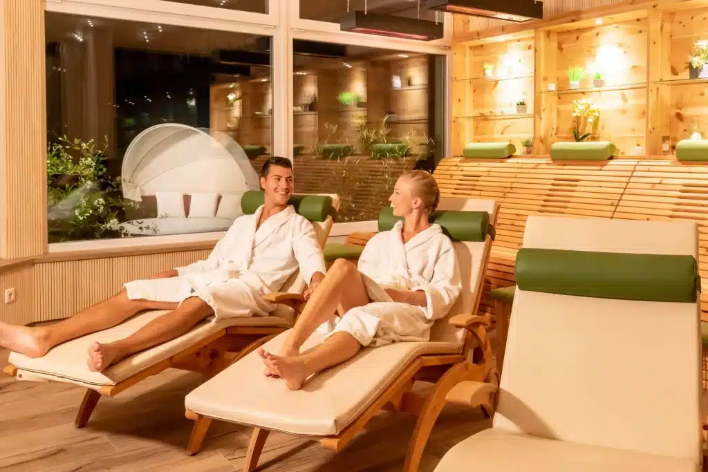
We are located in Birkendorf at 800 metres in the Rothauser Land, close to the Swiss border. For excursions into the Hotzenwald, it is best to plan a whole day. After your return, our Wellness area invites you to warm up: indoor pool (84 m²), panoramic sauna with forest view, garden sauna (swimwear allowed), herbal steam sauna (bio sauna) and Kneipp water-treading pool, open daily from 09:00 to 20:00.
Our Arrangements include accommodation, breakfast buffet, gourmet menu, afternoon snack buffet and use of the spa facilities; the KONUS guest card is also included. You will find further hiking tips on the page Hiking holiday in the Black Forest. You can see available rooms on the Book page.
Frequently asked questions
Where is the Hotzenwald?
The Hotzenwald lies in the Southern Black Forest in the Waldshut district, between the valleys of the Wehra and the Alb and north of the High Rhine.
Where does the name Hotzenwald come from?
According to Wikipedia, it probably comes from the “Hotzen”, the wide baggy trousers of the Hauenstein costume. The spelling “Hotzawald” is first documented in 1848.
Which places belong to the Hotzenwald?
As core municipalities, Wikipedia names Rickenbach, Herrischried, Dachsberg and Görwihl. The portal of Hotzenwald Tourismus GmbH presents Görwihl, Herrischried and Rickenbach.
Which hike is suitable for half a day?
The circular tour from Görwihl into the Albschlucht to the Höllbachwasserfall is 7.28 km long, takes about 3 hours and is rated easy by Schwarzwald Tourismus.
Who were the Salpeterer?
According to the municipality of Herrischried, Salpeterer collected calcium saltpetre from stable walls for black powder production. Hotzenwald farmers resisted the power ambitions of the St. Blasien monastery in the 18th century.
How far is the Hotzenwald from your hotel?
You can reach Görwihl in around 38 km, about 45 minutes by car; Herrischried in around 44 km, about 45 minutes.
Sources
- Wikipedia: Hotzenwald (delimitation, name, geology, history)
- Hotzenwald Tourismus GmbH: Region und Gemeinden
- Schwarzwald Tourismus: Southern Black Forest / High Rhine
- Schwarzwald Tourismus: Hotzenwald-Querweg
- Schwarzwald Tourismus: Hotzenwald Höhenweg
- Schwarzwald Tourismus: Görwihl, Albschlucht and Höllbachwasserfall
- Schwarzwald Tourismus: From the Solfelsen to the Heidenwuhr
- Schwarzwald Tourismus: Rickenbach, Hotzenwald Höhenweg
- Schwarzwald Tourismus: Heimatmuseum Hotzenwald
- Schwarzwald Tourismus: Freilichtmuseum Klausenhof
- Municipality of Herrischried: Salpeterer tour
- Albsteig Schwarzwald: overview
- Schluchtensteig: stage 6 Todtmoos – Wehr
You might also like
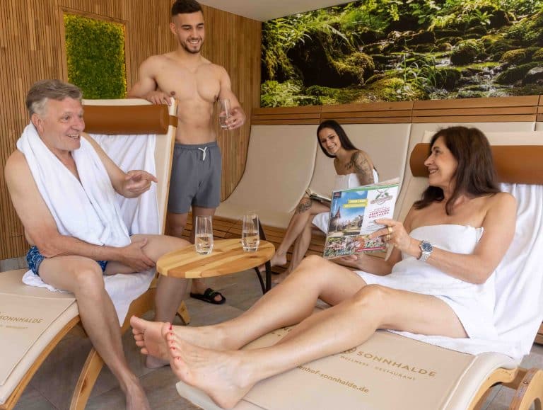
Textile Sauna Black Forest: Milder Sauna at Hotel Sonnhalde
Textile sauna Black Forest at Hotel Sonnenhof + Sonnhalde: 65–70°C, swimwear worn, ideal for sauna beginners. Wellness area at an altitude of 800 m.
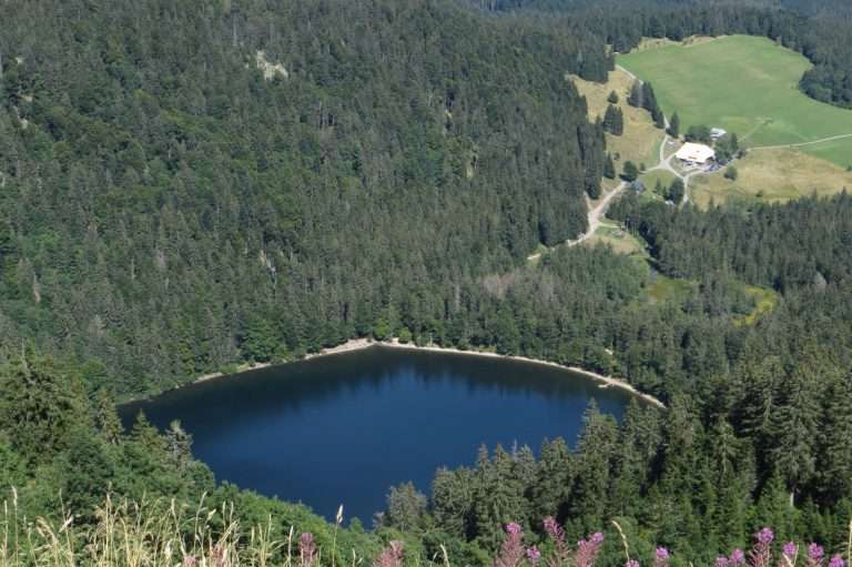
Field Lake: Round-trip route, hiking trail, and how to get there
Feldsee at the Feldberg: cirque lake at 1,100 m, circular tours of 6.5 to 12 km, access, parking, no swimming, refreshments. Plus weather and winter tips
Black Forest kirsch (Schwarzwälder Kirschwasser): origin, production and enjoyment
What is kirsch, where does Black Forest kirsch (Schwarzwälder Kirschwasser) come from and how is it made? An overview of protected origin, distilling cherries, distillation and enjoyment.
